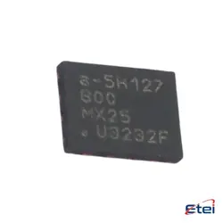
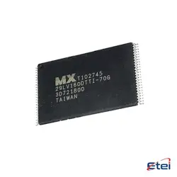
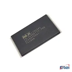
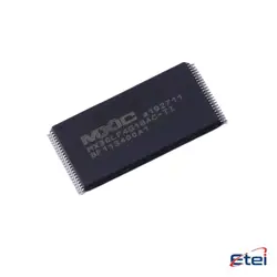
圖片僅供參考
規格
| 屬性 | 價值 |
| Manufacturer | KEC Semicon |
| Package | SOT-23 |
| Pd-PowerDissipation | 200mW |
| Current-Collector(Ic) | 100mA |
| Collector-EmitterVoltageVCEO | 50V |
概述
Description
The KRC102S-RTK/P is a high-precision GNSS RTK receiver designed for surveying, mapping, and geospatial applications. Key features include:
- Multi-constellation support (GPS, GLONASS, Galileo, BeiDou) for improved accuracy.
- Real-Time Kinematic (RTK) positioning with centimeter-level precision.
- IP67-rated rugged design for durability in harsh environments.
- Bluetooth & UHF radio for flexible data transmission.
- Long battery life (up to 15 hours) for extended fieldwork.
Ideal for land surveying, construction, agriculture, and GIS, it offers fast initialization and reliable performance. Compatible with various software and base stations, it enhances productivity in demanding conditions.
- Multi-constellation support (GPS, GLONASS, Galileo, BeiDou) for improved accuracy.
- Real-Time Kinematic (RTK) positioning with centimeter-level precision.
- IP67-rated rugged design for durability in harsh environments.
- Bluetooth & UHF radio for flexible data transmission.
- Long battery life (up to 15 hours) for extended fieldwork.
Ideal for land surveying, construction, agriculture, and GIS, it offers fast initialization and reliable performance. Compatible with various software and base stations, it enhances productivity in demanding conditions.
Equivalent
The KRC102S-RTK/P chip is a GNSS module. Equivalent products include:
- ublox ZED-F9P (high-precision RTK)
- Quectel LC79D (multi-band GNSS)
- SkyTraq S1216F8 (RTK-capable)
- Trimble BD990 (high-end RTK)
These alternatives offer similar RTK and multi-GNSS support for precise positioning. Choose based on compatibility, cost, and feature requirements.
- ublox ZED-F9P (high-precision RTK)
- Quectel LC79D (multi-band GNSS)
- SkyTraq S1216F8 (RTK-capable)
- Trimble BD990 (high-end RTK)
These alternatives offer similar RTK and multi-GNSS support for precise positioning. Choose based on compatibility, cost, and feature requirements.
Pinout
The KRC102S-RTK/P is a 5-pin relay module with the following functions:
1. Pin 1 (IN+) – Positive control input (typically 3-32V DC).
2. Pin 2 (IN-) – Negative control input (ground).
3. Pin 3 (COM) – Common terminal for the relay switch.
4. Pin 4 (NO) – Normally Open contact (connects to COM when relay is activated).
5. Pin 5 (NC) – Normally Closed contact (disconnects from COM when relay is activated).
This single-pole double-throw (SPDT) relay is commonly used for switching high-voltage/current circuits (up to 250V AC or 30V DC) via a low-voltage control signal. It is often applied in automation, power control, and IoT devices.
1. Pin 1 (IN+) – Positive control input (typically 3-32V DC).
2. Pin 2 (IN-) – Negative control input (ground).
3. Pin 3 (COM) – Common terminal for the relay switch.
4. Pin 4 (NO) – Normally Open contact (connects to COM when relay is activated).
5. Pin 5 (NC) – Normally Closed contact (disconnects from COM when relay is activated).
This single-pole double-throw (SPDT) relay is commonly used for switching high-voltage/current circuits (up to 250V AC or 30V DC) via a low-voltage control signal. It is often applied in automation, power control, and IoT devices.
Application
The KRC102S-RTK/P is a high-precision GNSS receiver module, primarily used in:
1. Precision Agriculture – Autonomous tractors, yield monitoring.
2. Surveying & Mapping – Cadastral surveys, topographic mapping.
3. Construction – Machine control, site grading.
4. Drones (UAVs) – Aerial photogrammetry, LiDAR mapping.
5. Autonomous Vehicles – Navigation for robots, AGVs.
6. Marine & Hydrography – Bathymetric surveys, dredging.
It supports RTK (Real-Time Kinematic) for centimeter-level accuracy, making it ideal for applications requiring high-precision positioning.
1. Precision Agriculture – Autonomous tractors, yield monitoring.
2. Surveying & Mapping – Cadastral surveys, topographic mapping.
3. Construction – Machine control, site grading.
4. Drones (UAVs) – Aerial photogrammetry, LiDAR mapping.
5. Autonomous Vehicles – Navigation for robots, AGVs.
6. Marine & Hydrography – Bathymetric surveys, dredging.
It supports RTK (Real-Time Kinematic) for centimeter-level accuracy, making it ideal for applications requiring high-precision positioning.
Package
The KRC102S-RTK/P is a surface-mount device (SMD) package, typically in a compact QFN (Quad Flat No-leads) or similar form factor, designed for high-precision RTK (Real-Time Kinematic) GNSS applications. Its small size and efficient thermal performance suit embedded systems. Exact dimensions vary; refer to the datasheet for specifics.